Scramble for Africa
Once Europeans recognized the vast potential of Africa and had the means to explore and exploit the resources there, a land boom began. European nations quickly sent in explorers to claim land and natural resources. At the Berlin Conference the Europeans drew up boundaries for the entire continent of Africa while ignoring ethnic, religious and linguistic lines.
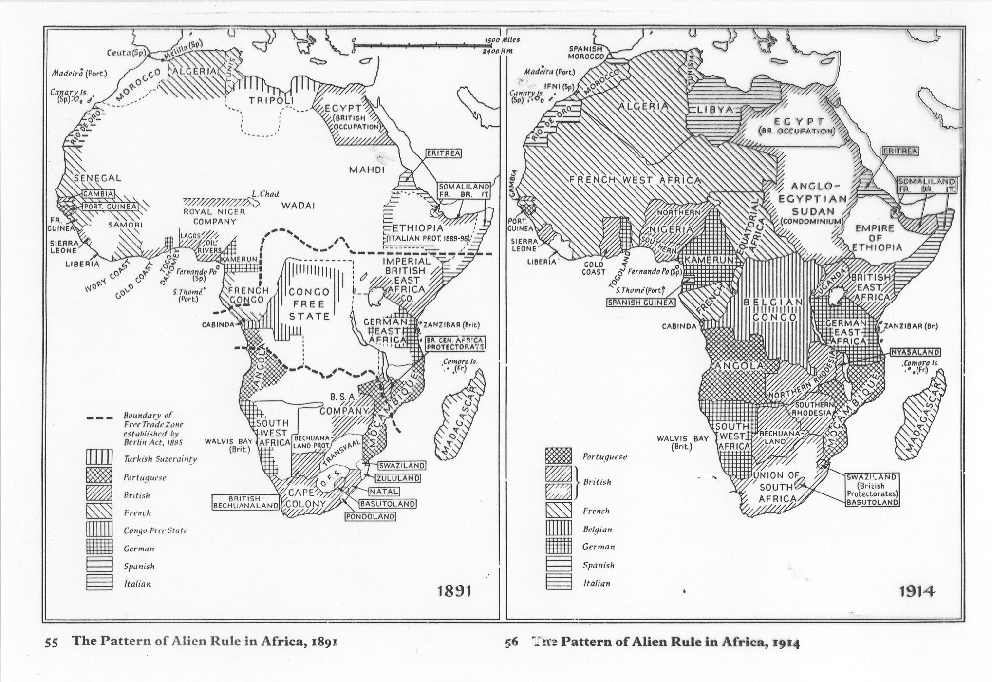
Part 1 of 1: Download and Print out the map of Imperialist Africa and label the items below. Maps should be colored appropriately with a color coded key indicating by color which European country controlled which colony. Map can be found here
Colonies:
Algeria
Libya
Sierra Leone
Liberia
Gold Coast
TogoLand
Nigeria
French west Africa
Cameroons
French Equatorial Africa
Belgian Congo
Angola
German Southwest Africa
Union of South Africa
German East Africa
Mbini
Northern and Southern Rhodesia
Portuguese East Africa
Bechuanaland
British East Africa
Anglo-Egyptian Sudan
Ethiopia
Italian Somaliland
British Somaliland
Egypt
Uganda
Madagascar
Eritrea
Cities:
Johannesburg
Khartoum
Algiers
Addis Ababa
Mogadishu
Cairo
Tripoli
Monrovia
Bodies of Water:
Atlantic Ocean
Nile River (Draw in)
Lake Victoria
Lake Tanganyika
Mediterranean Sea
Red Sea
Niger River (Draw in)
Congo River (Draw in)
Zambezi River (Draw in)